Brazil in Data: Disasters,
Environment, and Society
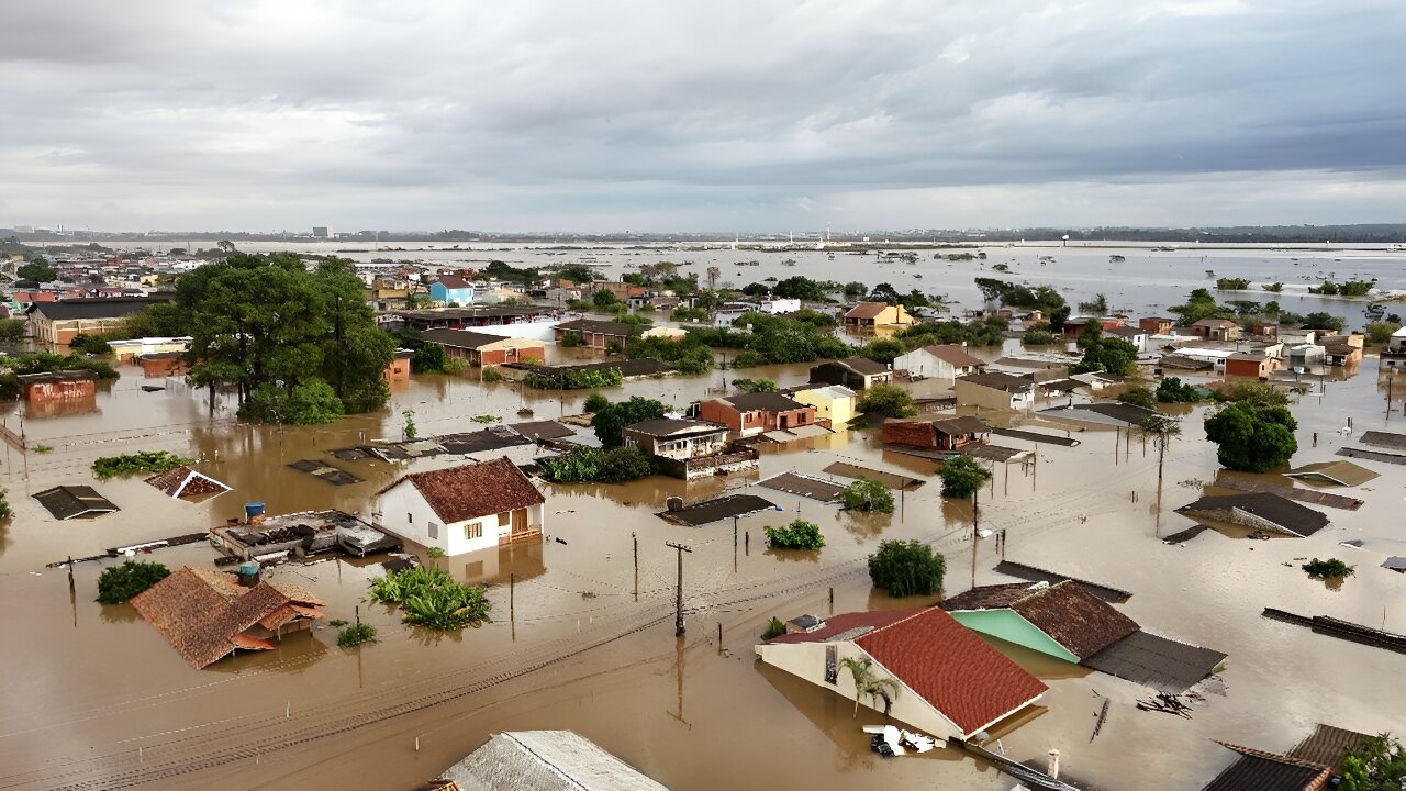
How Rio Grande do Sul was submerse: April-May 2024
Learn More
In addition to focusing on Rio Grande do Sul, OpenDataFlood contextualizes the state within the broader national landscape, comparing rainfall intensity and public spending with other Brazilian states.
The project utilizes a wide range of datasets, including meteorological data, public spending records, and environmental indicators, to analyze the factors that led to the flood. It also examines the role of public policies in disaster preparedness and response.
By making this data accessible and visualizing it through interactive maps and charts, OpenDataFlood aims to raise awareness about the vulnerabilities of Brazilian states to climate change and the importance of effective public policies in mitigating such disasters.
Using monthly precipitation records from meteorological stations across Brazil.
Through long-term data on urban expansion and deforestation at the municipal level.
By analyzing historical federal investments in civil defense actions (2014–2025).
Based on the national system for disaster notifications (S2ID), showing patterns of climate-related emergencies across municipalities.
The 2024 flood in Rio Grande do Sul was not an isolated event but the result of complex and interconnected factors. While the affected municipalities did not show sharp increases in urban sprawl or extensive deforestation at the local level, Brazil’s broader environmental and climatic systems reveal deeper structural vulnerabilities.
Rio Grande do Sul is Brazil’s southernmost state, home to approximately 11 million people—around 5% of the country's total population. It is one of Brazil's most economically developed regions, with a strong agricultural, industrial, and service-based economy. As such, a natural disaster in this region carries broad national consequences, affecting supply chains, food production, and infrastructure.
In May 2024, the state experienced one of the worst floods in its history. According to official data, over 2.3 million people were directly affected, with more than 400 municipalities impacted by heavy rains, river overflows, landslides, and infrastructure collapse. Cities like Porto Alegre, the capital, faced record-breaking water levels and mass displacements.
Scientific research shows that deforestation in key biomes like the Amazon and the Cerrado has far-reaching effects on rainfall distribution across the South American continent. These changes in the atmospheric water cycle can intensify extreme weather events even in regions geographically distant from the deforested areas.
This project uses official open data from Brazilian institutions—such as INMET, IBGE, MapBiomas, and the Transparency Portal—to trace these connections. It integrates precipitation patterns, land use data, and public investment in disaster prevention to shed light on the systemic nature of climate risk in Brazil. Rio Grande do Sul is analyzed in detail, but always in the context of national patterns of environmental change and institutional preparedness.
By revealing spatial and temporal patterns through data visualization, OpenDataFlood aims to inform climate governance, support evidence-based policy, and promote public engagement with environmental accountability.